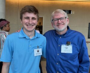
When University of Mary Washington junior Ethan Sweeny began a summer internship working alongside Professor of Geography Steve Hanna, he knew he’d signed up for something special.
“I immediately knew it was something I was going to really enjoy doing,” said Sweeny, a geospatial analysis major who worked with Hanna last summer and throughout the fall to help create the Stafford African American Heritage Trail. “Using what I’ve learned in class in a real-world project was really rewarding, but I think the most rewarding thing I took from it was being able to help tell these amazing stories that might have been lost.”
The trail, a 23-stop driving tour, highlights the strength and resilience of African American people in Stafford County throughout the past 300 years. Officially unveiled during a recent ceremony at Stafford Hospital, it also showcases the connection between UMW and the local community, and the power of professors to include students in research and other important endeavors.
“This is exactly what so many of my colleagues at Mary Washington strive to do,” Hanna said at the unveiling event, where he and Sweeny, who’s also pursuing a certificate in GIS, learned they’d been named in a House Resolution by the Virginia General Assembly in praise of the project. “We involve our students in projects with community partners to create works of consequence, projects that make a difference in this region and across the globe.”
Historic preservation majors and 2024 graduates Noah Brushwood, along with Brooke Prevedel and Eliza Vegas, both of whom earned a certificate in GIS, also were named in the resolution for their work on the maps and the stories that bring the trail to life.
Hanna, known for bringing students into community initiatives like Fredericksburg’s Civil Rights Trail and the Fredericksburg Area Museum’s Lafayette’s World exhibit, jumped at the chance to work on the African American Heritage Trail, initiated by Discover Stafford Director Sue Henderson. And when Prevedel, Vegas and Brushwood graduated last May, he called on Sweeny to help finish the job.


With data already collected, design prototypes created and story summaries written, he dove in, using ArcGIS mapping software to tie the material – along with images and video –together in layers and paint a cohesive picture for the trail and each of its stops. His story-maps, both print and digital, consider color theme and other aesthetics, allowing tour-takers to navigate the narratives by scrolling and clicking on imbedded links to learn more.
Working at least eight hours a week – sometimes nearly twice that, even throughout the summer – Sweeny met monthly with an advising committee, answering questions, processing feedback and meeting deadlines. And he maintained constant contact with Hanna and Henderson, even joining them for a January Town Talk radio spot promoting the trail.
“I feel very fortunate to have worked on such an impactful and important project that allowed me to take my classroom skills and use them to help the local community,” Sweeny said. “I hope this trail will continue to serve as a storybook and as a voice for the future.”

